Step into the unique and mysterious ecosystem of the Aokigahara Jukai Forest on our private, English-guided tour. Your journey includes walking on the young lava field, learning about the area’s volcanic history and unique biology, and visiting the spiritual Ryugu Cave (lava tube) and Shrine. For a complete experience, you have the option to extend your adventure with a short hike to the Sankodai Viewpoint, where you can enjoy a breathtaking panorama of the forest, the three lakes, and Mount Fuji.
All Our Tour
/Private tour
/English-speaking guide
/Learn about the history and biology of the area
/Plenty of photo opportunities
Transportation
Free pick-up and drop-off at Kawaguchiko Station or your hotel (within the Kawaguchiko and Saiko area) is included in the hiking tour.
Itinerary
Aokigahara Jukai Tour
Pick-up at the station (20 min)
Mt. Fuji Viewpoint (10 min)
Jukai trail (80 min) including Ryugu Cave and Shrine
Return to the station or drop-off point (20 min)
total time 2 hours 30mins
Optional: Extra 45 min for Sankodai Viewpoint
Pick-up Time
9:00 or 12:30 at Kawaguchiko Station ( Dec – Feb )
9:00 or 13:30 at Kawaguchiko Station ( Mar – Nov )
Price
Aokigahara Jukai Tour:
20,000 yen per group (up to 4 people)
Aokigahara Jukai and Sankodai Viewpoint Tour:
22,000 yen per group (up to 4 people)
*3,000 yen per additional person
*Our booking and payment system is operated in partnership with HAMAYOU Resort
Solo Hiker Eco-Discount
If you’re happy to travel in our compact car, we offer a significantly reduced rate.
It’s better for the environment and better for your budget.
Aokigahara Jukai Tour:
10,000 JPY (Regularly 20,000 JPY)
Aokigahara Jukai and Sankodai Viewpoint Tour:
11,000 JPY (Regularly 22,000 JPY)
Solo hiker option / Bookings more than 1 month in advance / Custom requests:
Please fill out the form below, and we will get back to you personally.
Places We Visit
Aokigahara Jukai
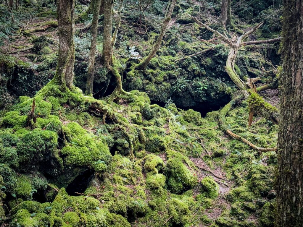
The forest that formed on top of the lava is called Aokigahara Jukai. There isn’t much earth or much water, this 35ha huge forest formed in very harsh conditions. Volcanic rocks don’t contain water which is critical for plants. How do they survive? The key is moss. Moss grows first. It sucks the moisture from the air and contains water. Plants rely on this water. Trees spread their roots over moss and take water from it. But there still isn’t enough water, so the species of trees that can survive here are limited. They are mostly deciduous trees. Because of the volcanic ground, trees are not able to reach their roots underground so they often fall over. Some keep growing towards the sun and others die and become the soil. This is how forests form.
It is still a very young forest. We are going to see how the forest is growing and how all the plants and animals are taking part in forming the forest.
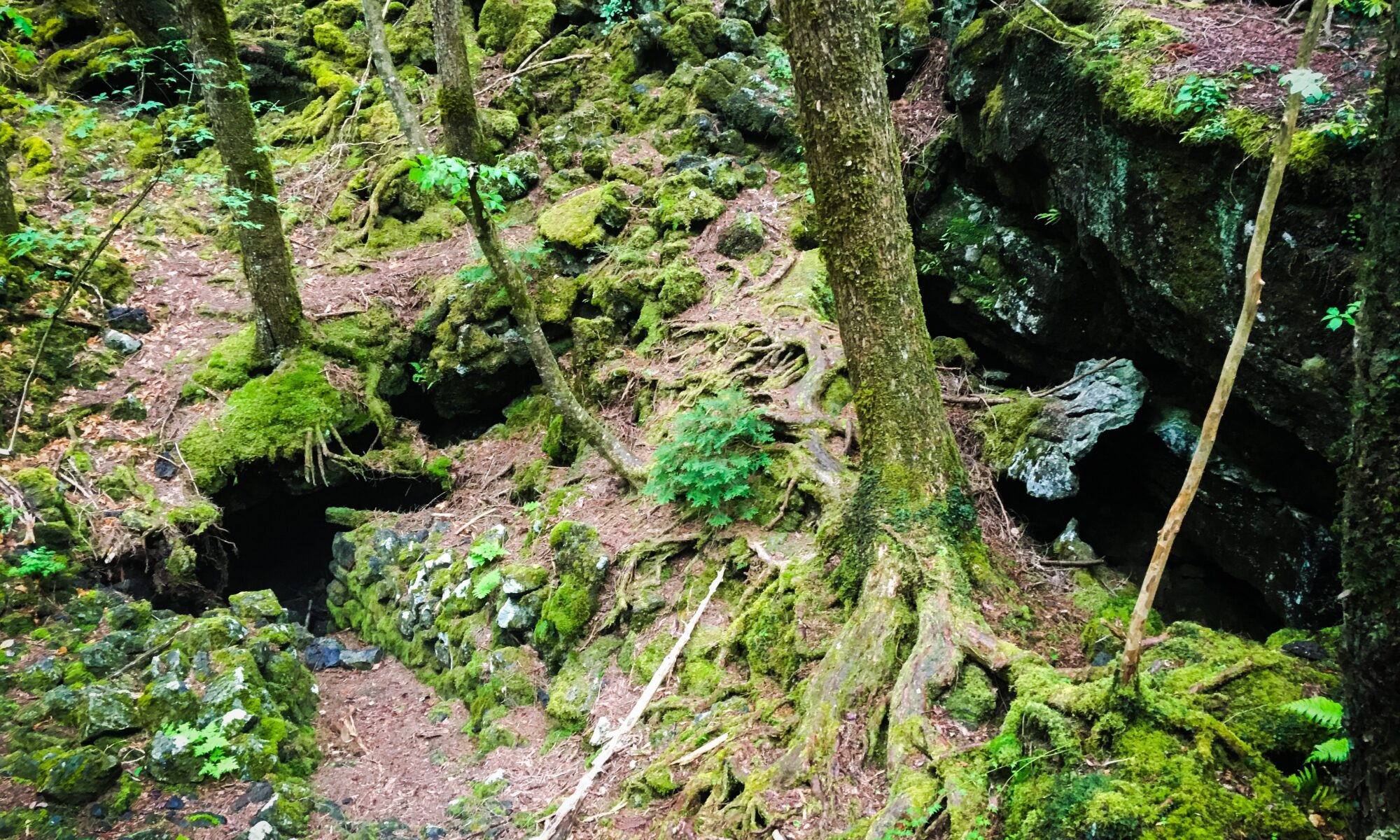
Ryugu Cave (Dragon Cave) and Shrine
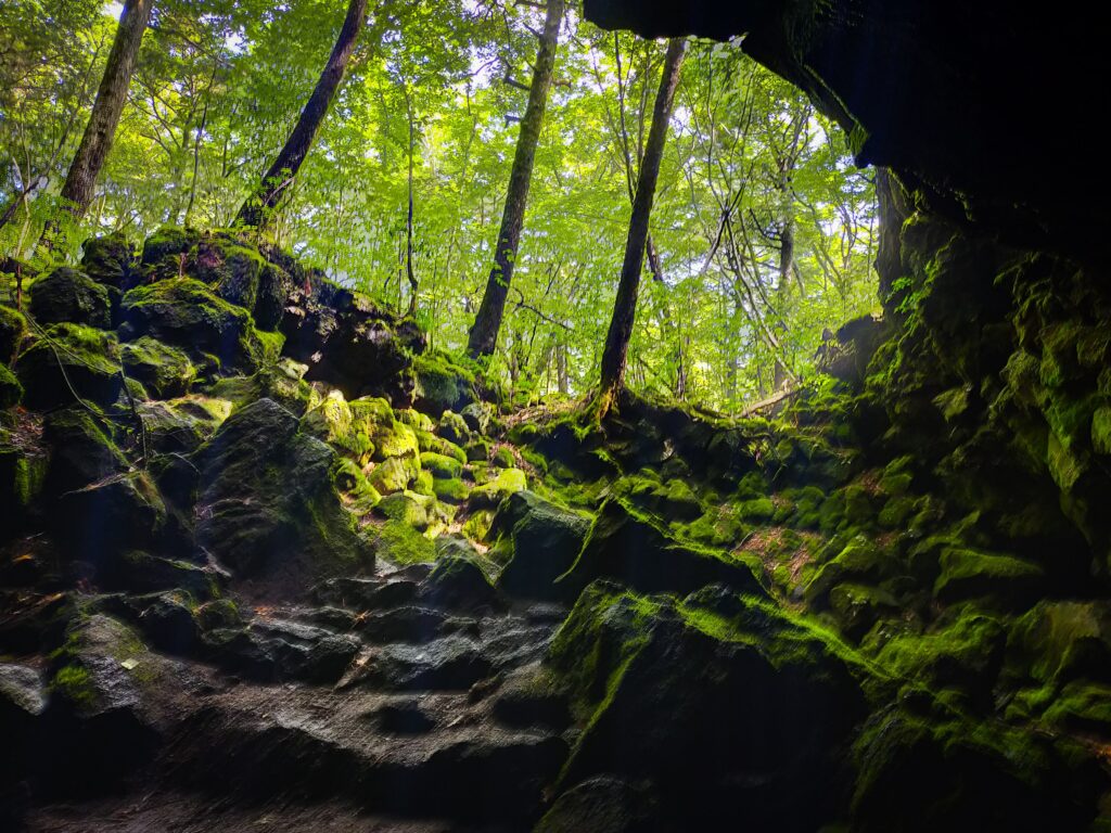
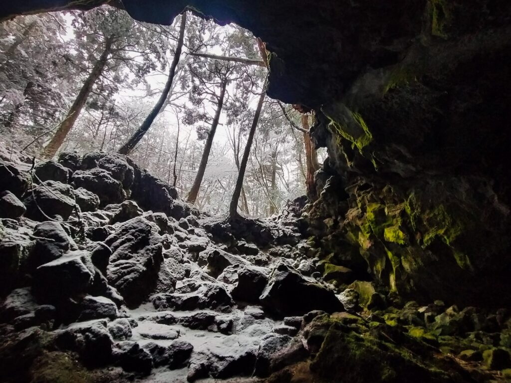
When the lava flowed, the surface cooled down and became solid first. The lava below kept flowing and created empty spaces there. Also as the water evaporated and the air was trapped inside the lava. This makes caves.
Ryugu cave is one of those caves. Local people enshrined the dragon god here and they still come to pray for rain.
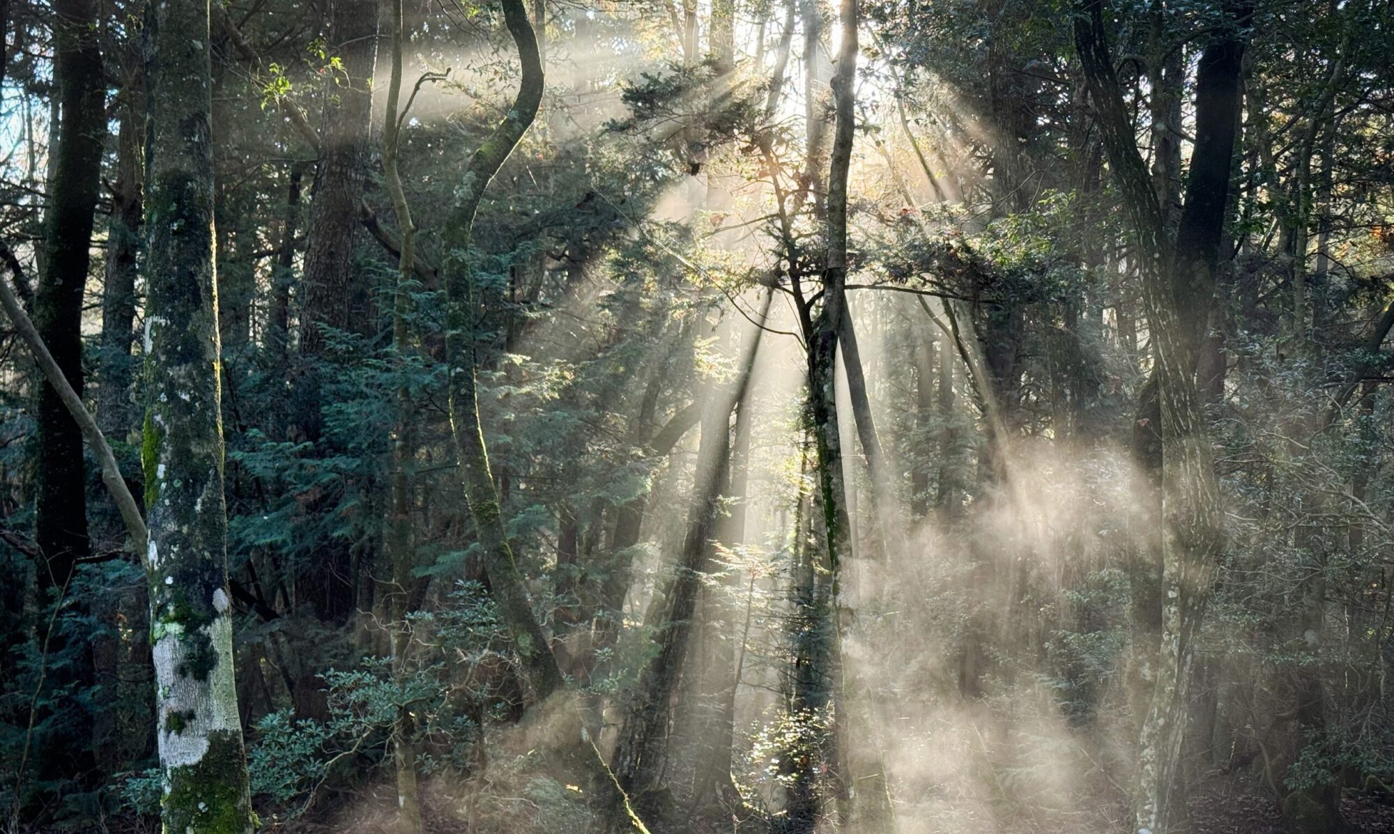
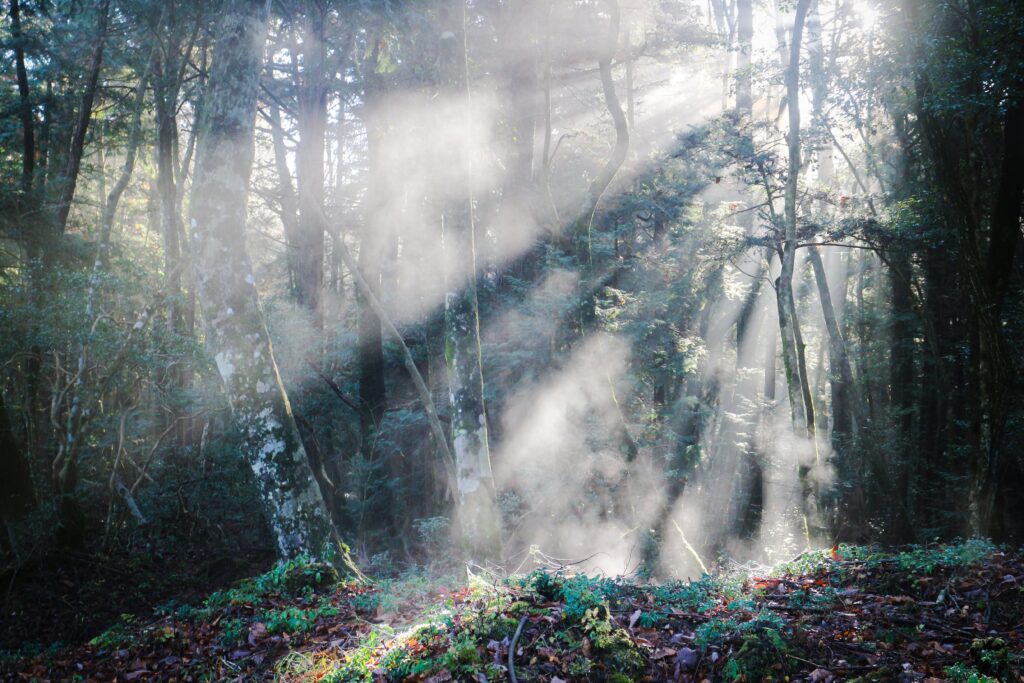
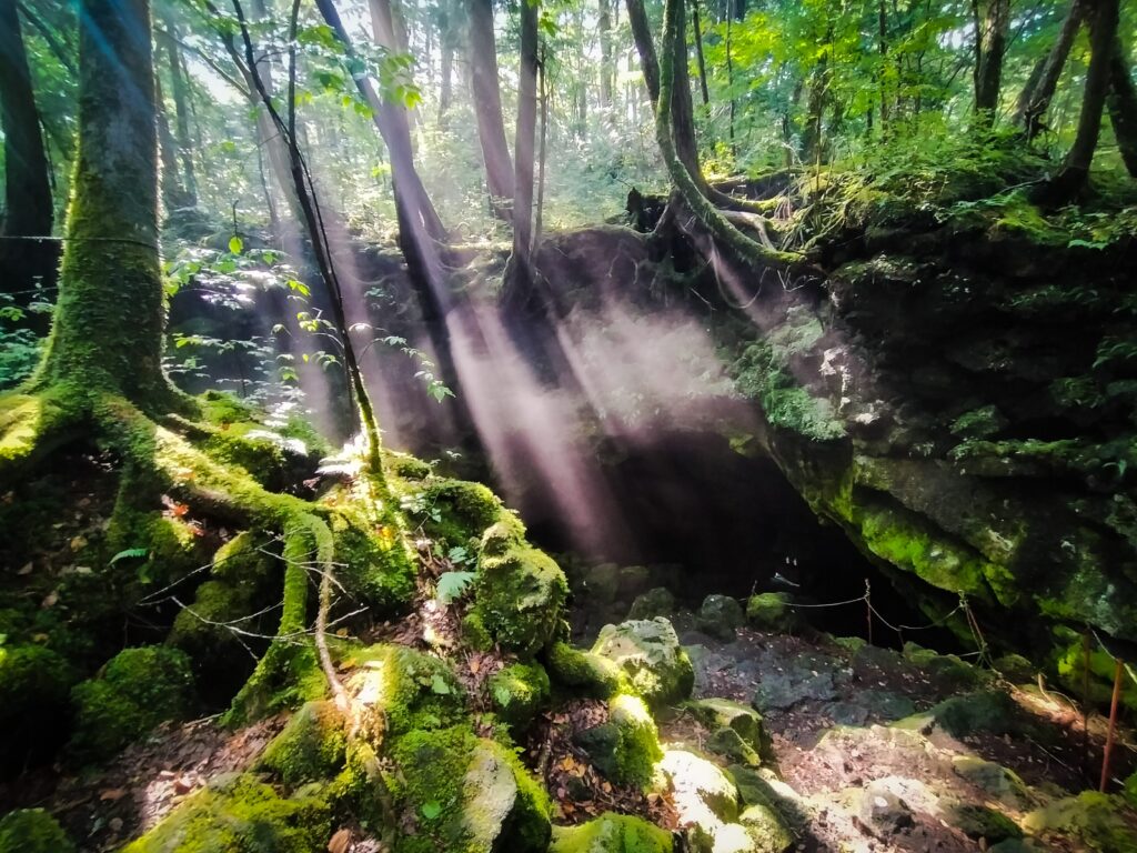
Because the air inside is kept at the same temperature most of the year around, It becomes a natural air conditioner. When you walk in Jukai Forest, you sometimes feel the cool air that might be coming from underneath.
In summer, the cool air rises up, the sun shines on it and makes a sunlight curtain.
Sankodai Viewpoint (Optional)
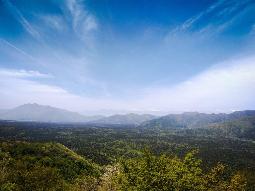
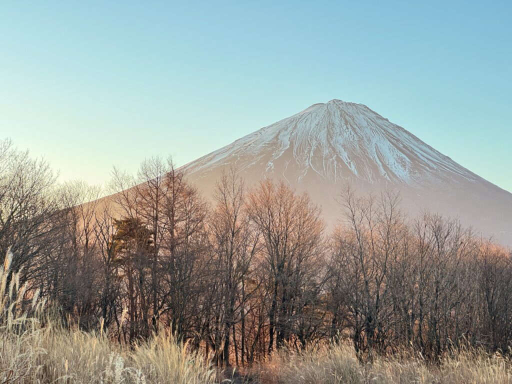
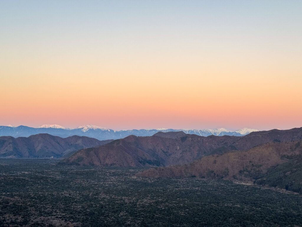
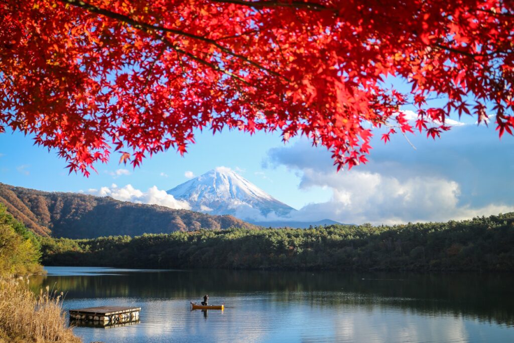
Sankodai viewpoint is located on Mt. Ashiwada. This mountain blocked the lava flow from reaching the east part of Lake Saiko. Here you can see the vast jukai forest and all 3 lakes at the same time. This is also a good viewpoint for Mt. Fuji. You can see the difference between the jukai forest and the older forest here.
This area is also known as Koyodai, which means red leaf hill. It is particularly beautiful in autumn when you can see the changing colours.
At the bottom of the hill there is a stable for native Japanese horses. People practice traditional Japanese equestrian skills, such as Yabusame, which is mounted archery.
Lake Saiko and Nemba Beach
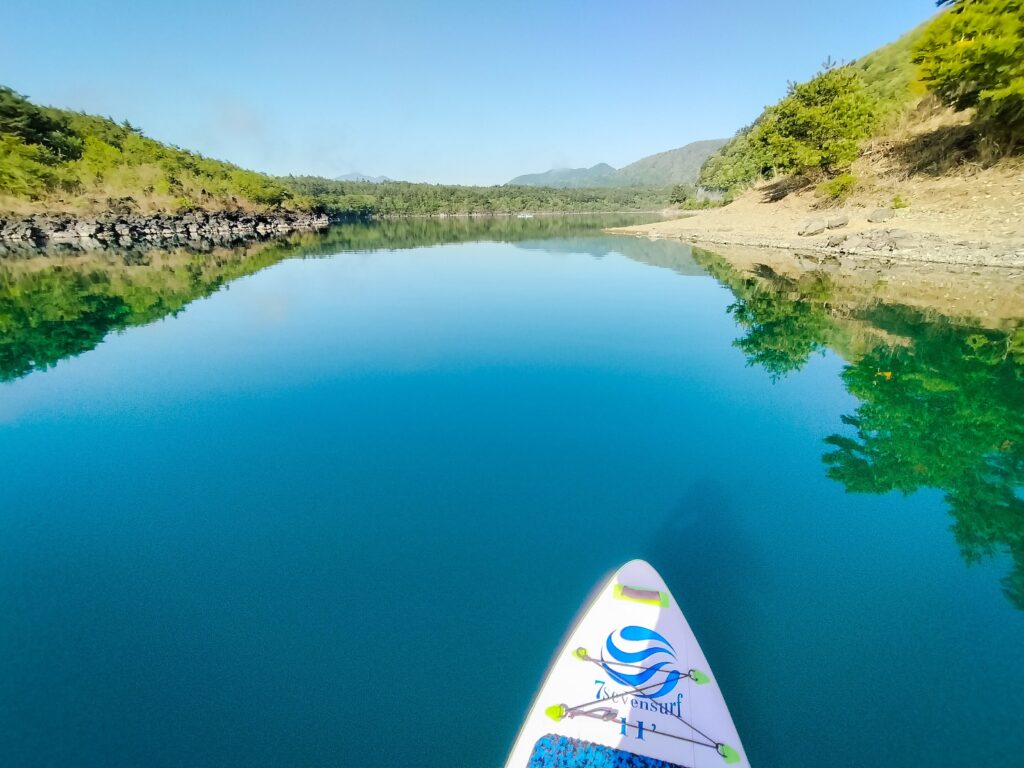
Lake Saiko is one of the 2nd deepest lakes in Mt. Fuji area. Since it’s surrounded by rich forest, it has abundant spring water from the bed of the lake.
The beautiful turquoise colour lake is home for a lot of freshwater fish.
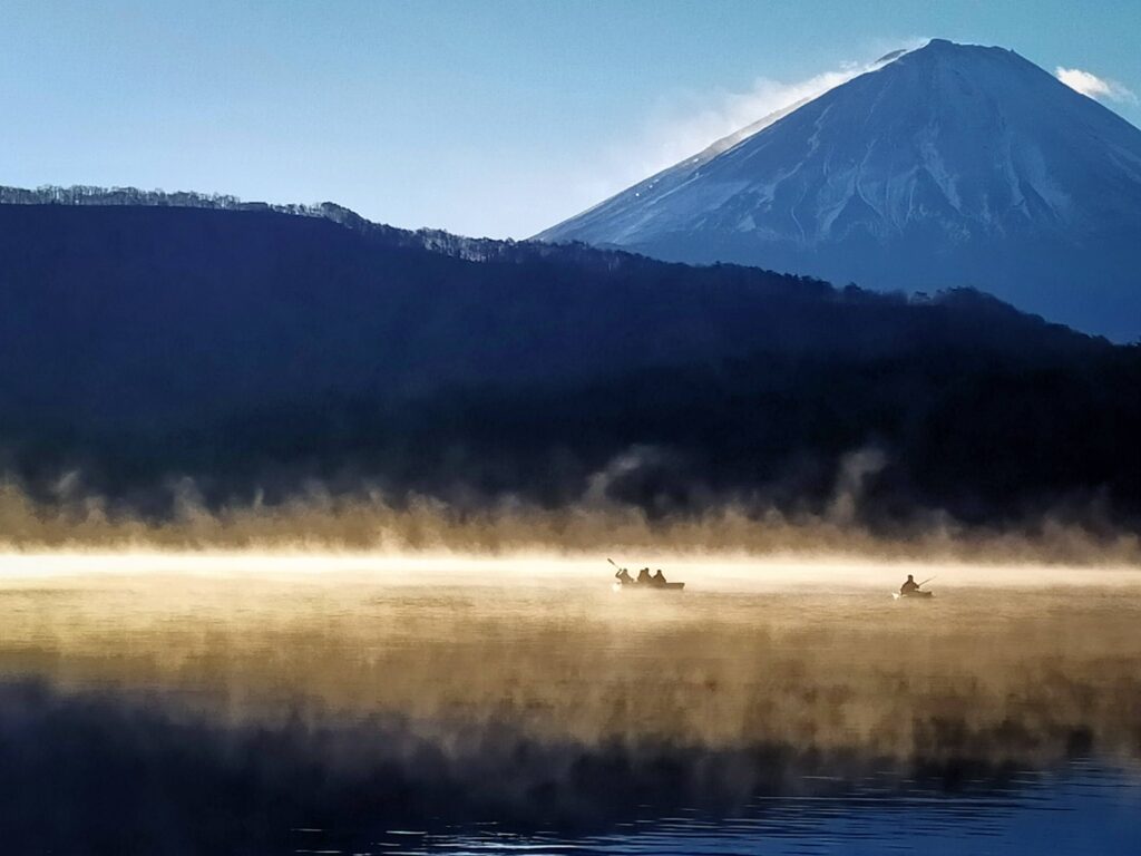
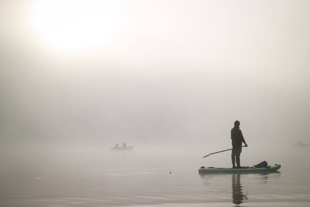
On windless late autumn and winter mornings mist (kearashi) forms on the lake, enveloping the entire surface and creating a fantastical scene.
Nemba Village (Optional)
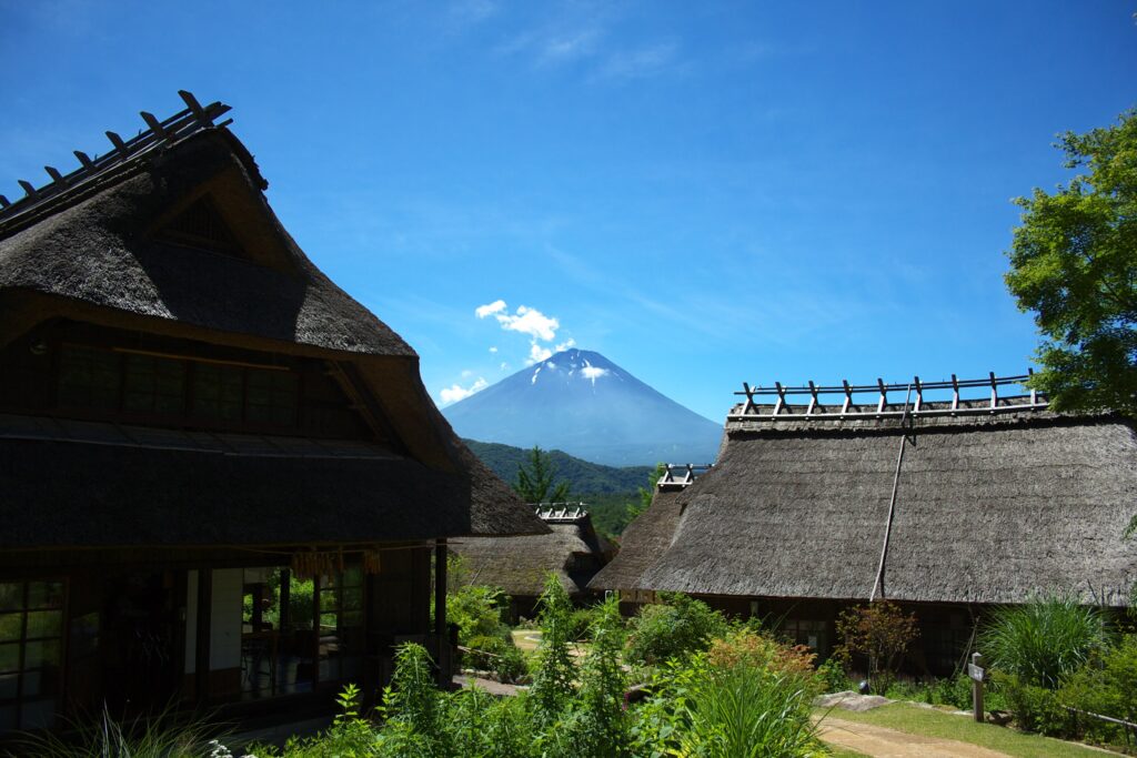
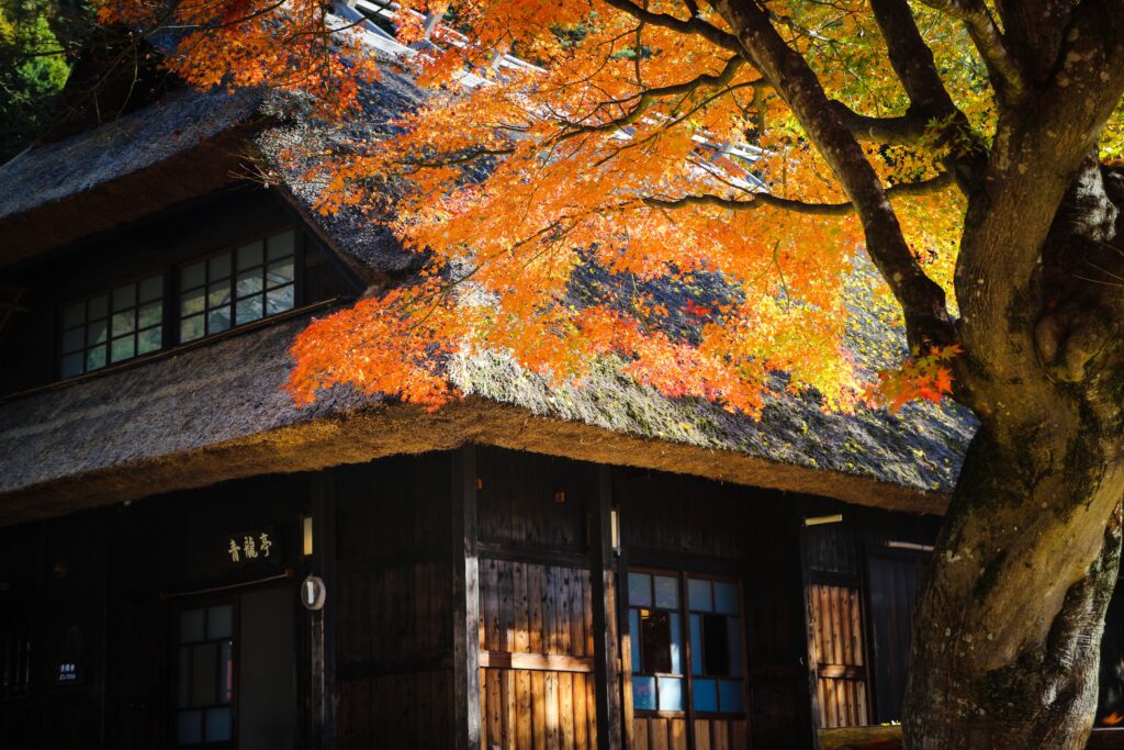
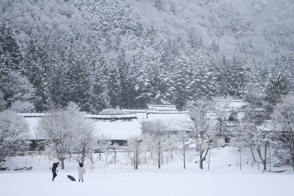
Nemba village is a restored old village consisting of traditional style thatched roof houses.
There was a huge landslide more than 60 years ago. Lots of people died and the village was destroyed.
The village was rebuilt and is now a popular tourist spot.